
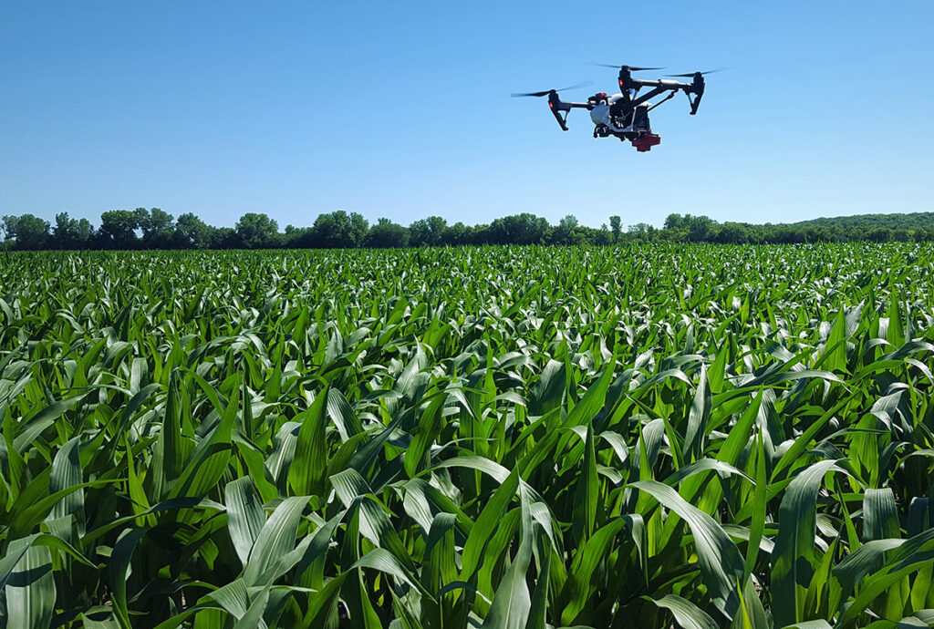
Precision matters in modern-day business and as such we ensure that all your enterprise needs are met with our above industry standard technology and innovation. The underground exploration, Precision Agriculture, Forestry & Environmental Assessments solutions include Crop Health Monitoring, Plant Height Profiling, Canopy Structure Analysis, Total Tree Counts, Wood Volume Calculation Watershed Modelling
The solution is in demand for agricultural companies and interested stakeholders including but not limited to crop insurance companies, auditing firms that conduct bio-audits on large scale farming projects, and plantations that require rapid post-disaster assessments and risk analysis.
For insurance companies, Knowledge is power when it comes to efficient claims processing and the safe deployment of inspection agents. Data from credible resources allows adjusters to more safely maneuver through potentially hazardous conditions. Having accurate geographic information to pinpoint potential asset damage before deploying inspection teams can aid in faster claim resolution and provide more efficient claim processing. Looking to trusted resources that offer key data on approaching catastrophes can help teams better prepare for the situation at hand. The level of accuracy is much more with an eye in the sky and giving timeously and error-free information for all the responsible parties.
For forestry companies, monitoring plant height and health has never been this easy, and as such, drone solutions become much more essential. In addition to Wildlife monitoring – Regrettable to mention, that one of the greatest dangers of forests is the liabilities and perils to wildlife and biodiversity. Embracing its association with flora and fauna, forests have to be monitored to ensure their protection of the same. With the help of our drone solutions, the balance of the ecosystem can be maintained, to better degrees. Aerial imagery, mapping, and data processing as performed by our AI-powered drones express endangerment alerts, scan for potential threats to wildlife, and so on. Time-critical results help to validate data and provide relief and medication in worsened conditions.


Subscribe to our newsletter to stay up to date with Afrostain Farmtech advancements and announcements.